Introduction
Unmanned aerial vehicles (UAVs) have grown to become a critical part of the inspection toolkit, bringing major efficiencies to asset integrity management programs. Used to conduct general visual inspections (GVI), close visual inspections (CVI), and thermographic inspections at both onshore and offshore facilities, they bring most benefit in hard-to-reach, live areas such as flares, tanks, underdecks, risers, chimneys, and cooling towers.
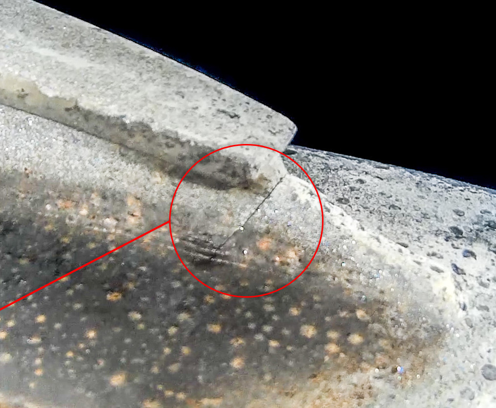
UAV inspection avoids sending personnel into high, hazardous areas and spending lengthy periods of time in confined spaces thus lowering the risks associated with the job, too. Cost savings can reach seven figures thanks to faster inspection and avoidance of unplanned shutdowns. Importantly, these efficiencies are not to the detriment of data quality, thanks to camera payloads able to pick up even the smallest defect, for example a hairline crack inside a tank.
During a typical work scope, UAVs collect hundreds of gigabytes of imagery and video footage, which can then be analyzed and used to create condition-based inspection reports. This use case, however, merely scratches the surface of the true potential of this visual data. Advancements in data management have unlocked ways to generate even further efficiencies and the ability to glean more value from the data.


Comments and Discussion
Add a Comment
Please log in or register to participate in comments and discussions.